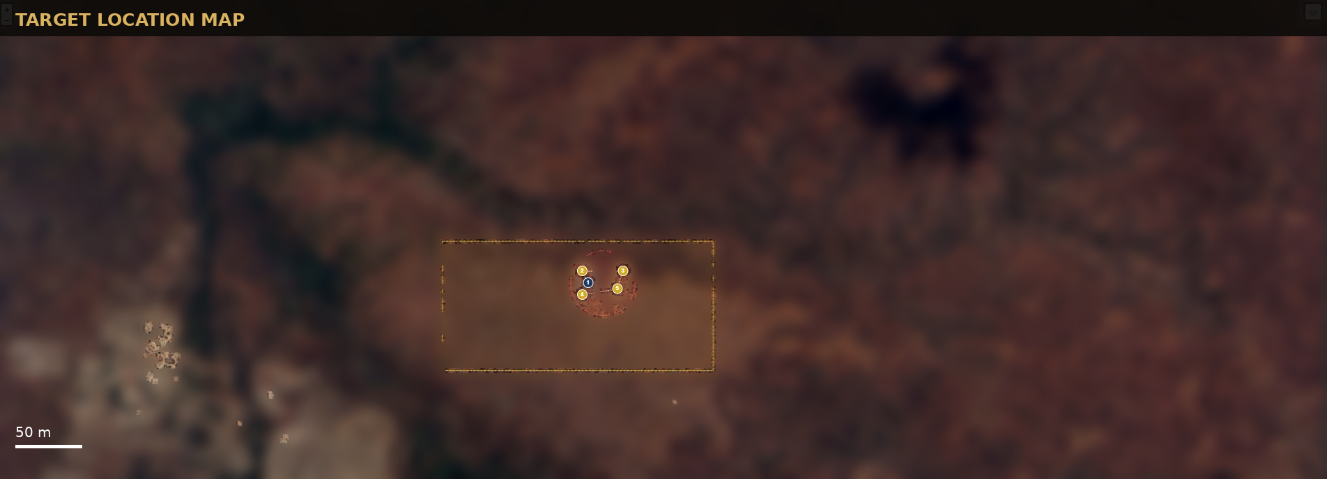
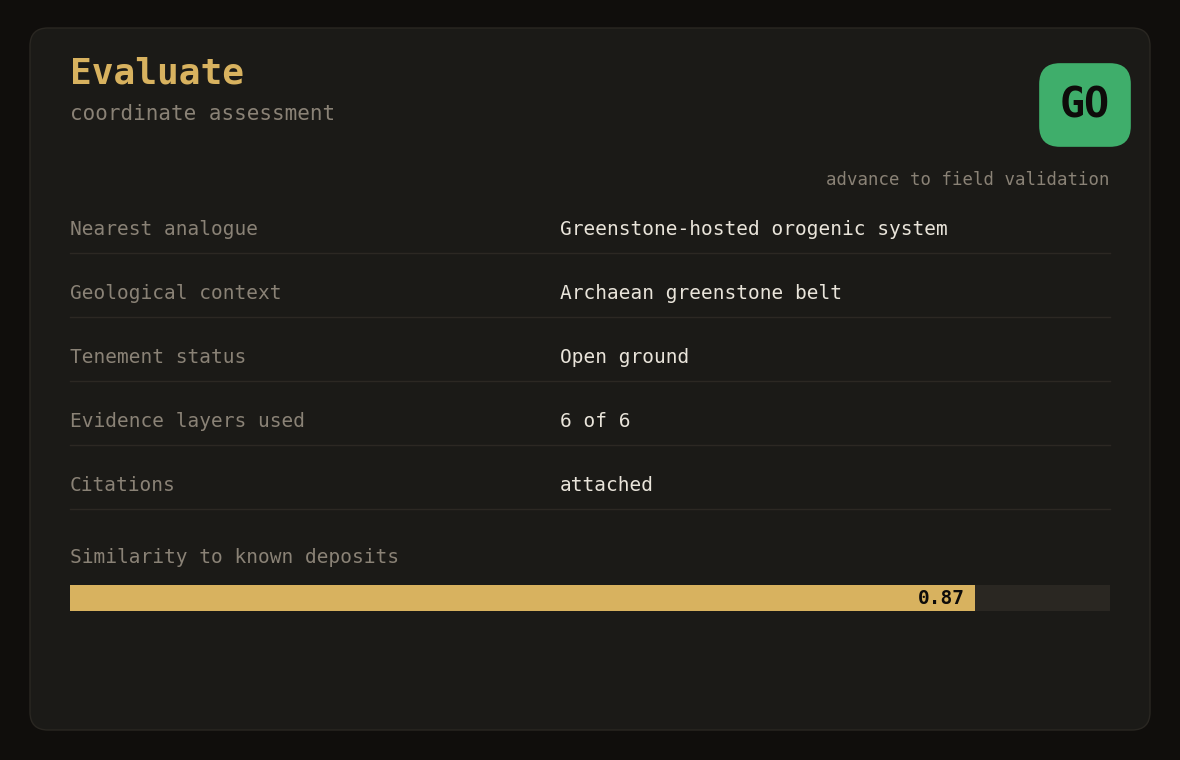
Evaluate a coordinate
Submit a location and receive a clear prospectivity rating, its licensing and availability status, and a straightforward go / no-go recommendation, ready to act on.
Assessing the ground before the capital, with discipline rather than assumption.
We have developed an in-house machine-learning capability that evaluates the gold prospectivity of land across Tanzania.
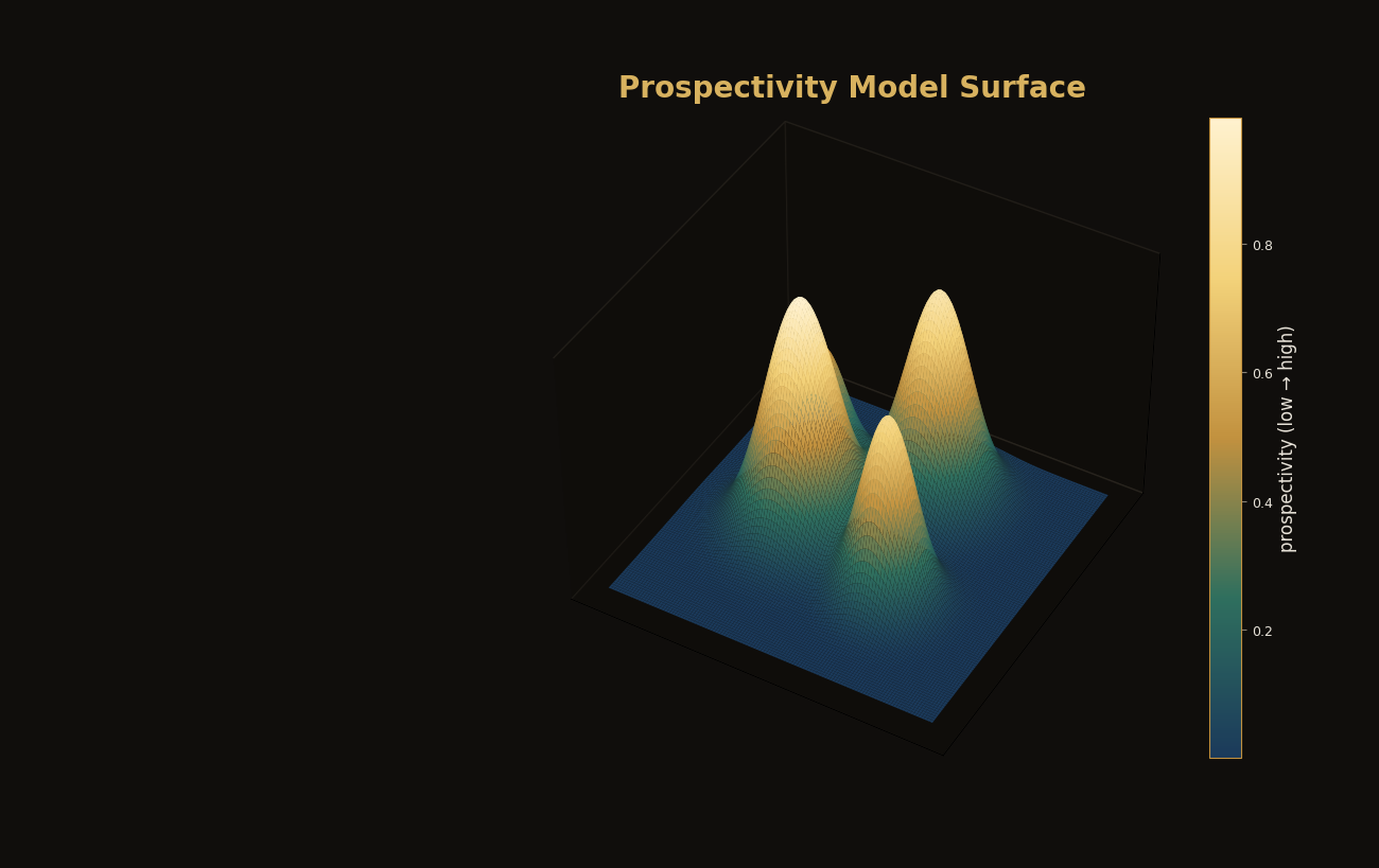
It brings artificial intelligence and satellite earth-observation together to read the ground, turning complex terrain into a clear, comparable picture of where gold potential is highest, quickly and objectively.
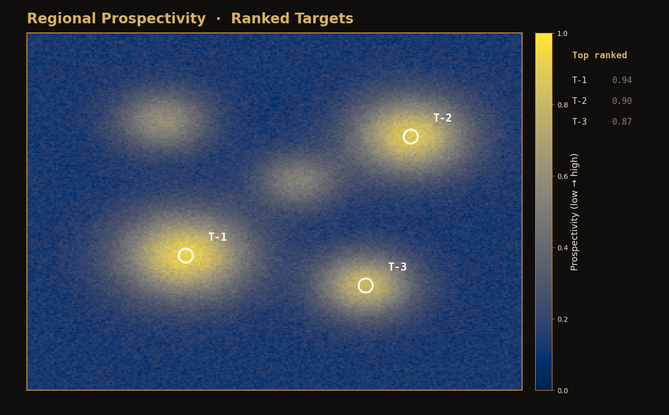
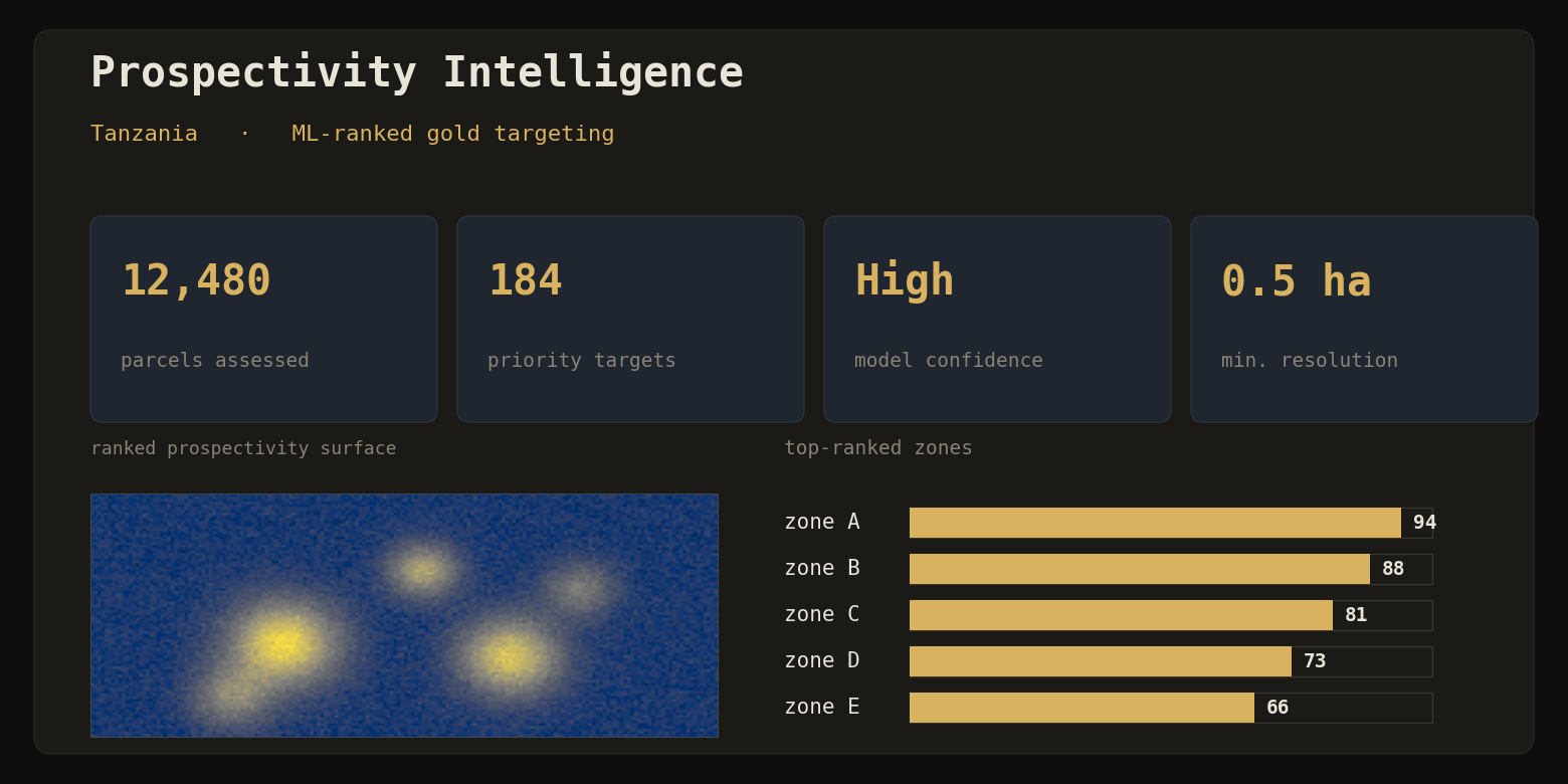
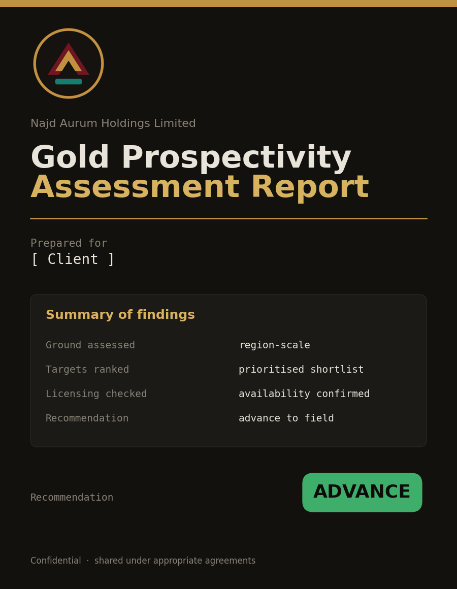
The outcome is consistent, repeatable assessment at scale: prospective ground ranked and prioritised so decisions rest on evidence rather than assumption. The methods behind it are proprietary and developed entirely in-house.
Multi-source satellite and geological data, unified into one view.
Raw signals refined into meaningful predictive indicators.
A trained model scores every parcel objectively and repeatably.
Decision-ready targets, prioritised and clear.
What the model considers
How our in-house engine turns earth-observation data into ranked, decision-ready gold targets.
Submit a location and receive a clear prospectivity rating, its licensing and availability status, and a straightforward go / no-go recommendation, ready to act on.
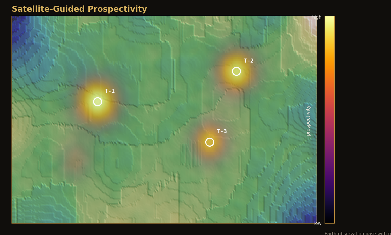
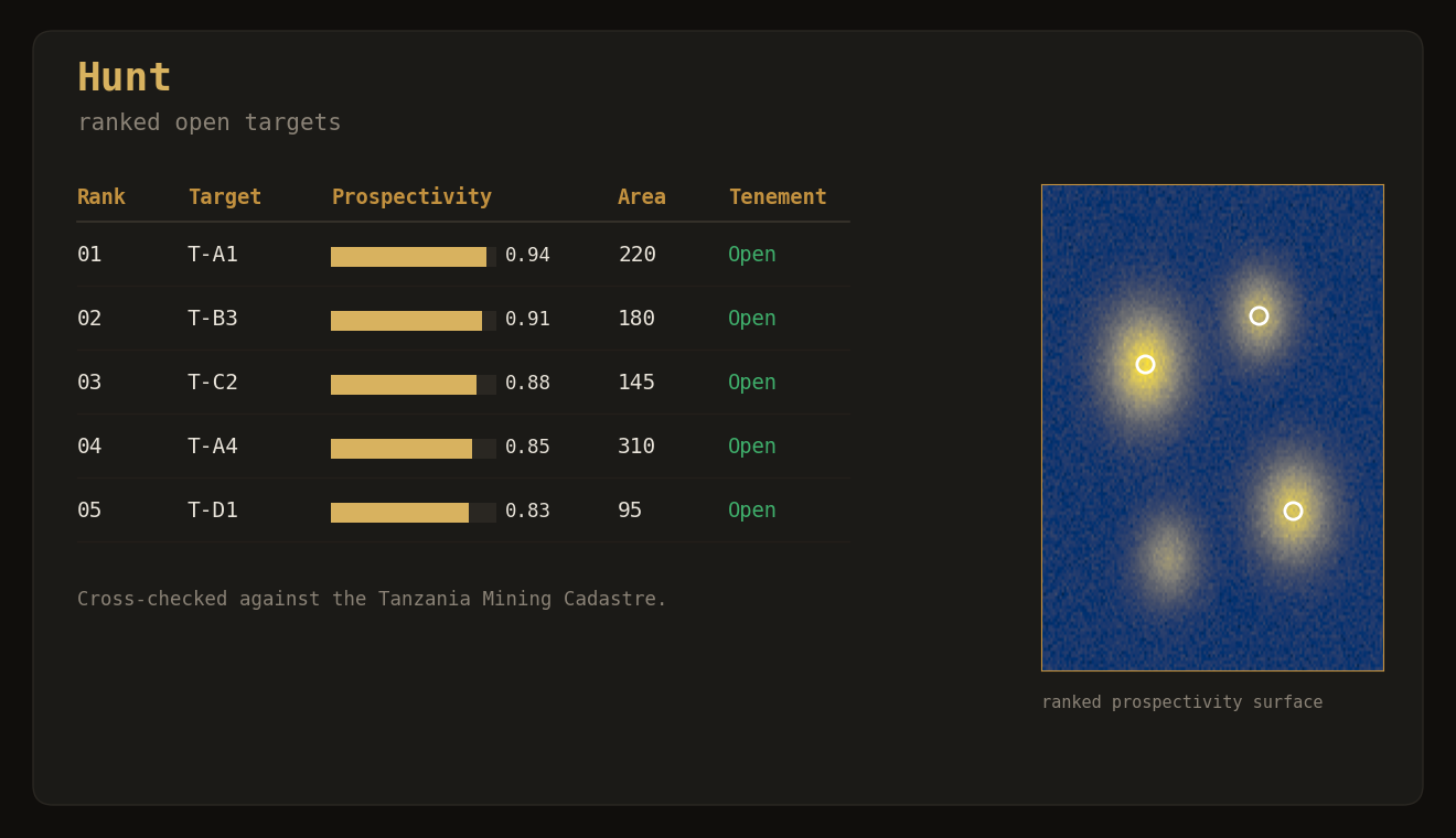
Scan an area and receive a ranked shortlist of the highest-potential available ground, so time and budget go straight to what matters most.

Earth-observation is a core strength. We turn satellite earth-observation into actionable exploration insight at scale.
Technology developed in-house by our own team, giving objective, repeatable scoring in place of subjective assessment.
Field data captured through structured digital forms, producing clean, consistent, auditable records from the ground up.
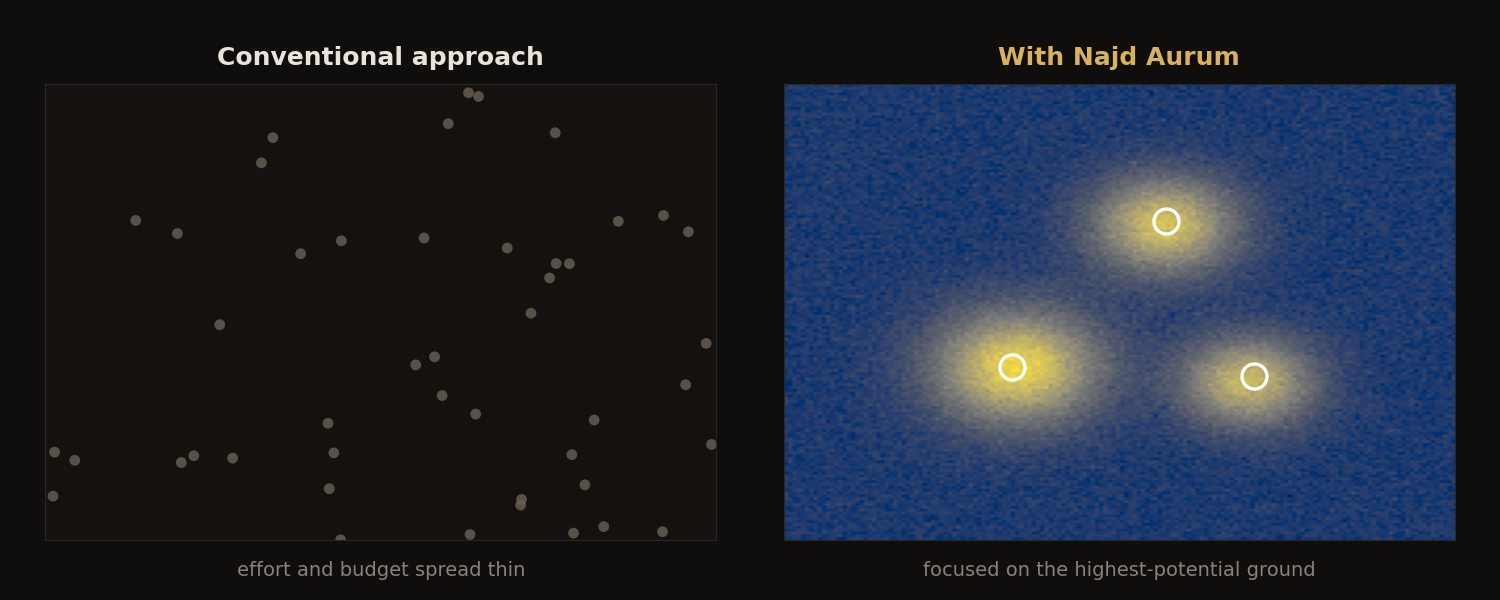
Exploration effort and budget focused on a small number of high-potential targets instead of being spread thinly.
Ground judged against the deposit models that genuinely apply to it, not a single global assumption.
Capital and fieldwork are directed to the highest-potential ground first.
Consistent, model-driven scoring in place of subjective judgement.
Applicable across Tanzania and adaptable to wider African and Asian settings.
Sharper targeting means a lighter footprint and more disciplined exploration.
Detailed methodology and results are shared directly under appropriate agreements.